Inquiry List
0 item(s) - POA- 0 Demolitions
- 1 Substructure
- 2 Superstructure
- 3 Finishes
- 4 Fixtures
- 5 Services
- 5A Sanitary Appliances
- 5B Specialist Equipment
- 5D Mechanical Installation
- 5H Electrical Installations
- 5J Smarthome Automations/Controls
- 5K Mobile computers/POS/Tablets/Printers
- 5N Builders Work in Connection
- 5P Facilities Management
- 5Q Prefabrication Services and Welding
- 5R EV Charging Infrastructure
- 6 External Works
- 7 Site setup
- 8 Builder Supplies
- 9 Home+Garden
- 10 Builders / Trades
- 11 Services etc
- 11A Registered Architects
- 11B Cost Advisors/Quantity Surveyors (QS) Services
- 11C Structural Engineer
- 11D Civil Engineer
- 11E Clerk of Works
- 11F Mechanical Engineer
- 11G Electrical Engineer
- 11H Landscape Architect
- 11J Noise Consultant
- 11K CDM Co-Ordinator
- 11L Fire Consultant/Assessor
- 11M Asbestos Consultant
- 11N Building Surveyor
- 11P Archaeologist
- 11Q Arboriculturist
- 11R Planning Consultant
- 11S Estate Management/Valuations
- 11T Abseiling Services
- 11U Demolition Consultant
- 11V EPC Assessor
- 11W Chartered Architectural Technologists
- 11X Web Designers
- 11Y Designers
- 11Z Office Supplies and Equipment
- 11Z1 Computer Services
- 11Z2 Photographers
- 11Z3 Topographical/Aerial Drone Surveys
- 11Z4 Investment funds/business support services
- 11Z5 Insurance providers
- 11Z6 Design & Build Fitout Specialists
- 11Z7 Auto Electrics
- 12 Council Areas (NoI)
- 12A Antrim & Newtownabbey BC
- 12B Ards and North Down BC
- 12C Armagh City, Banbridge and Craigavon BC
- 12D Belfast City Council
- 12E Causeway Coast and Glens BC
- 12F Derry City and Strabane DC
- 12G Fermanagh and Omagh DC (Enniskillen)
- 12H Lisburn and Castlereagh CC
- 12I Mid and East Antrim BC
- 12J Mid Ulster DC (Dungannon)
- 12K Newry, Mourne and Down DC
- 12A Council Areas (SoI)
- 12AA Carlow County Council (Leinster)
- 12AB Dublin City Council (Leinster)
- 12AC Dun Laoghaire - Rathdown CC (Leinster)
- 12AD Fingal CC (Leinster)
- 12AE South Dublin CC (Leinster)
- 12AF Kildare CC (Leinster)
- 12AG Kilkenny CC (Leinster)
- 12AH Laois CC (Leinster)
- 12AI Longford CC (Leinster)
- 12AJ Louth CC (Leinster)
- 12AK Meath CC (Leinster)
- 12AL Offaly CC (Leinster)
- 12AM Westmeath CC (Leinster)
- 12AN Wexford CC (Leinster)
- 12AO Wicklow CC (Leinster)
- 12AP Clare CC (Munster)
- 12AQ Cork City Council (Munster)
- 12AR Cork CC (Munster)
- 12AS Kerry CC (Munster)
- 12AT Limerick City & CC (Munster)
- 12AU Tipperary CC (Munster)
- 12AV Waterford City & CC (Munster)
- 12AW Galway City Council (Connacht)
- 12AX Galway CC (Connacht)
- 12AY Leitrim CC (Connacht)
- 12AZ Mayo CC (Connacht)
- 12BA Roscommon CC (Connacht)
- 12BB Sligo CC (Connacht)
- 12BC Cavan CC (Ulster)
- 12BD Donegal CC (Ulster)
- 12BE Monaghan CC (Ulster)
High definition surveying (Per day)
| Brand: | Property Services NI |
Pricing for laser scanning and measured surveys by Property Services NI. Final quotation based on site address and client requirements. Drone Aerial Surveys brochure shall be available for free download on sending inquiry !
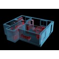
Deliverables include: 2D floor plans, 2D elevations, Revit models, Cross Sections, Lease plans, Asset plans, 3D Cad plans, Orthophotos, Scan to BIM, Heritage Surveys (Laser scanning has greatly increased the ability to provide detailed plans and models of important buildings and structures)
Additional servce of Converting Point Cloud Data day rate is £150/day + VAT
Cost includes travel and expenses within Ireland
What is QUANTUM?
On one website, namely QUANTUM by QUINTIN and to all considering minor repairs/renovations or new build, we have developed an efficient tool to speed up the inquiry process and availability of prices to users, to help make informed decisions, day or night, from all construction industry sources throughout Ireland, large or small, giving a cost effective platform for developing online business.
Competitive online prices are available 24/7, with each supplier having access to maintain product range and prices. When registered users view prices and decide to submit a best price inquiry or multiple best price inquiries about products or services, the chosen supplier contact receives an email for follow up call to discuss. Over time, we aim to display more suppliers and secure more competitive prices for users, with the widest product range available.


